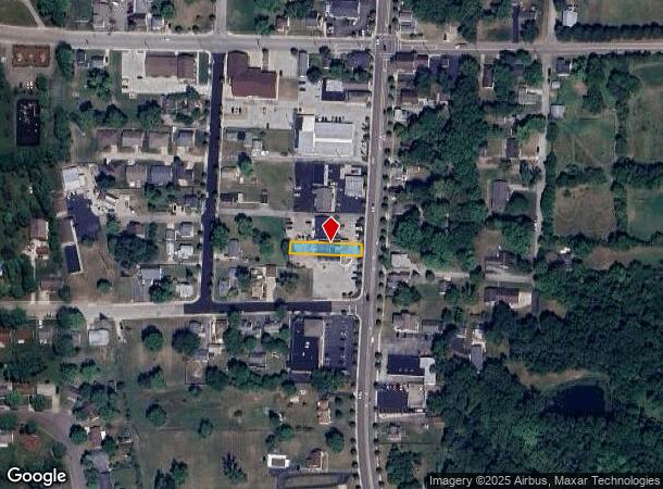
Property Record
114 S Main St, Union, OH 45322

NEARBY LISTINGS FOR SALE OR LEASE
Property Detail
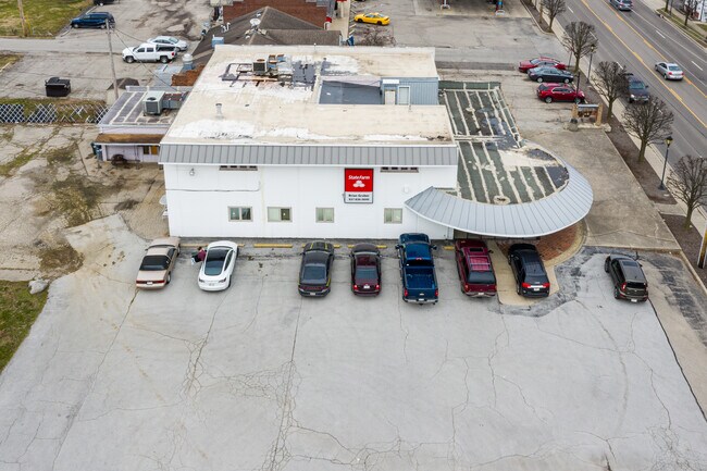
114 S Main St
Dayton, OH
Union Village
M58-00102-0023
38 PT 1-2-53
Storebuilding
Montgomery
X
Ohio
39109C0245E
23
2024
0.30 AC
2025
North Dayton
125000
Cincinnati/Dayton
8,648 SF
DEMOGRAPHICS near 114 S Main St
1 mile
3 mile
5 mile
2024 Total Population
3,720
19,258
44,285
2029 Population
3,647
18,890
43,698
Pop Growth 2024-2029
(1.96%)
(1.91%)
(1.33%)
Average Age
42
43
43
2024 Total Households
1,593
7,993
18,369
HH Growth 2024-2029
(2.01%)
(1.93%)
(1.31%)
Median Household Inc
$66,912
$68,455
$69,547
Avg Household Size
2.30
2.30
2.40
2024 Avg HH Vehicles
2.00
2.00
2.00
Median Home Value
$132,638
$163,440
$170,070
Median Year Built
1969
1973
1971
Nearby Places
Map Layers
Map Styles
 Street
 Aerial
Transit
 Traffic
 Biking
Places
Listings with unknown addresses are not visible on the map
- Restaurants
- Banks
- Shops
- Fitness
- Groceries
PUBLIC TRANSPORTATION
AIRPORT
James M Cox Dayton International
Drive
Walk
Distance
James M Cox Dayton International
12 min
6.1 mi
Freight Ports
Port of Toledo
Drive
Walk
Distance
Port of Toledo
177 min
146.5 mi
SALE & LEASE HISTORY
LISTING DATE
SALE/LEASE

Nov 08, 2019
For Sale
Mar 16, 2020
For Sale
Feb 11, 2020
For Lease
Feb 10, 2020
For Sale
Apr 24, 2018
For Sale
Nearby Properties
Address
Land Use
TOTAL SIZE
Lot Size
Zoning
Address
Land Use
TOTAL SIZE
Lot Size
Zoning
2,810,636 SF
79.21 AC
Address
Land Use
TOTAL SIZE
Lot Size
Zoning
1,841,033 SF
129.70 AC
Address
Land Use
TOTAL SIZE
Lot Size
Zoning
551,408 SF
71 AC
Address
Land Use
TOTAL SIZE
Lot Size
Zoning
52.03 AC
Address
Land Use
TOTAL SIZE
Lot Size
Zoning
1,059,902 SF
56.13 AC
Address
Land Use
TOTAL SIZE
Lot Size
Zoning
634,247 SF
86.18 AC
Address
Land Use
TOTAL SIZE
Lot Size
Zoning
834,238 SF
42.05 AC
Address
Land Use
TOTAL SIZE
Lot Size
Zoning
597,314 SF
38.27 AC
Address
Land Use
TOTAL SIZE
Lot Size
Zoning
527,904 SF
75.77 AC
Address
Land Use
TOTAL SIZE
Lot Size
Zoning
23,020 SF
15.14 AC
Address
Land Use
TOTAL SIZE
Lot Size
Zoning
25.82 AC
Address
Land Use
TOTAL SIZE
Lot Size
Zoning
222,799 SF
13.74 AC
Address
Land Use
TOTAL SIZE
Lot Size
Zoning
0.45 AC
Address
Land Use
TOTAL SIZE
Lot Size
Zoning
252,449 SF
19.41 AC
Address
Land Use
TOTAL SIZE
Lot Size
Zoning
82,155 SF
7.85 AC
Address
Land Use
TOTAL SIZE
Lot Size
Zoning
212,060 SF
29.77 AC
Address
Land Use
TOTAL SIZE
Lot Size
Zoning
4.37 AC
Address
Land Use
TOTAL SIZE
Lot Size
Zoning
Address
Land Use
TOTAL SIZE
Lot Size
Zoning
125,183 SF
10.51 AC
Address
Land Use
TOTAL SIZE
Lot Size
Zoning
87,797 SF
43.13 AC
Address
Land Use
TOTAL SIZE
Lot Size
Zoning
11,282 SF
11.60 AC
Address
Land Use
TOTAL SIZE
Lot Size
Zoning
37,299 SF
6.79 AC
Address
Land Use
TOTAL SIZE
Lot Size
Zoning
107,907 SF
20.54 AC
Address
Land Use
TOTAL SIZE
Lot Size
Zoning
88,642 SF
11.85 AC
Address
Land Use
TOTAL SIZE
Lot Size
Zoning
81,471 SF
9.92 AC
Address
Land Use
TOTAL SIZE
Lot Size
Zoning
24,264 SF
5.72 AC
Address
Land Use
TOTAL SIZE
Lot Size
Zoning
88,882 SF
4.75 AC
Address
Land Use
TOTAL SIZE
Lot Size
Zoning
70,388 SF
6 AC
Address
Land Use
TOTAL SIZE
Lot Size
Zoning
Address
Land Use
TOTAL SIZE
Lot Size
Zoning
56,102 SF
7.77 AC
The World's #1 Commercial Real Estate Marketplace
Connect with us
© 2026 CoStar Group
The information above has been obtained from sources believed reliable. While we do not doubt its accuracy we have not verified it and make no guarantee, warranty or representation about it. It is your responsibility to independently confirm its accuracy and completeness. Any projections, opinions, assumptions, or estimates used are for example only and do not represent the current or future performance of the property. The value of this transaction to you depends on tax and other factors which should be evaluated by your tax, financial, and legal advisors. You and your advisors should conduct a careful, independent investigation of the property to determine to your satisfaction the suitability of the property for your needs.